
Hike Stats:
SOTA Contacts:
| Time | Callsign | Band | Mode | Notes |
|---|---|---|---|---|
| 19:37 | KI6SLA | 144MHz | FM | |
| 19:37 | N6HEG | 144MHz | FM | 59 |
| 19:37 | WA6WV | 144MHz | FM | 59 |
| 19:38 | KM6UHU | 144MHz | FM | |
| 19:39 | KM6RNJ | 144MHz | FM | 59 |
| 19:40 | KI6PMD | 144MHz | FM | 59 |
| 19:42 | KN6DMO | 144MHz | FM | 59 |
| 19:42 | K6MAA | 144MHz | FM | 59 |
| 19:42 | NT6E | 144MHz | FM | 59 |
| 19:43 | KN6UIB | 144MHz | FM | 59 |
| 19:44 | KN6REL | 144MHz | FM | 55 |
| 19:44 | K6GP | 144MHz | FM | 57 from Norco |
| 19:45 | W6RWS | 144MHz | FM | 59 |
Hike Notes:
Important! If you are working VHF from this peak, you MUST use a bandpass filter. You are very close to Mount Wilson and right by the transmitting antenna for KCBS-TV.
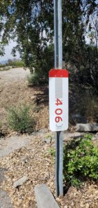
The trail head is on Mount Wilson Road, which branches off Angeles Crest Highway at Red Box. The trail head is unmarked and difficult to find. I use “Navigation” on the Alltrails app to pinpoint it. A mile marker “406” is across the street:

If you look closely behind those shrubs, you will see a trail head.
The trail is not well groomed. This is one of those rare places not touched by fire, so there are piles of dead leaves over the trail. It is easy to slip and stumble. You can also find yourself off trail. Parts of the trail are steep and rocky:

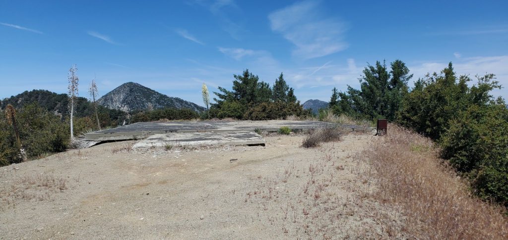
About a third of the way up is a helipad:
Maybe the last 1/4 mile before the peak, the trail vanishes. No problem it is easy to see the destination:
