Hike Stats:
SOTA Contacts:
| Time | Callsign | Band | Mode | Notes |
|---|---|---|---|---|
| 18:31 | NT6E | 144MHz | FM | |
| 18:31 | KM6UHU | 144MHz | FM | 55 |
| 18:33 | KN6CQX | 144MHz | FM | 59, mobile in Upland |
| 18:34 | N6HEG | 144MHz | FM | 59 LAX |
| 18:34 | KI6SLA | 144MHz | FM | 59 |
| 18:35 | N6XZN | 144MHz | FM | 59 Fontana |
| 18:36 | K6QCB | 144MHz | FM | 59 Rancho Cucamonga |
| 18:36 | WA6WV | 144MHz | FM | 59 Torrance |
Hike Notes:
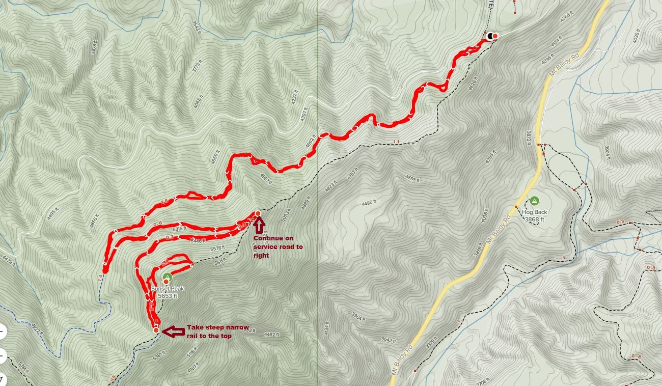
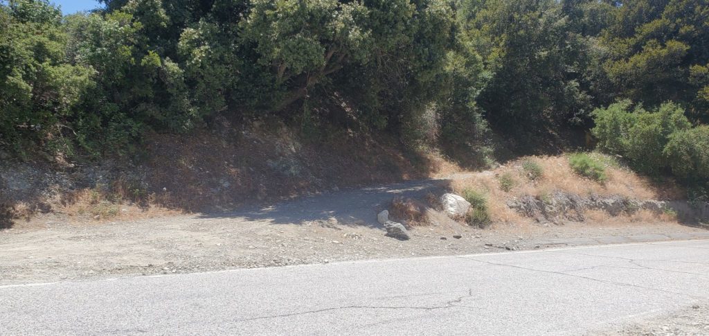
This hike is a good introduction to the more challenging peaks in the Mount Baldy area. Go up Mount Baldy Road, then make a hairpin left at Glendora Ridge Road. Make sure you do not park in the upper lot – the one with signs saying “no parking”. Park along the road as shown here.

The trailhead is not hard to find:
Take the fire road all the way up. Make a sharp right at the 2.5 mile point:
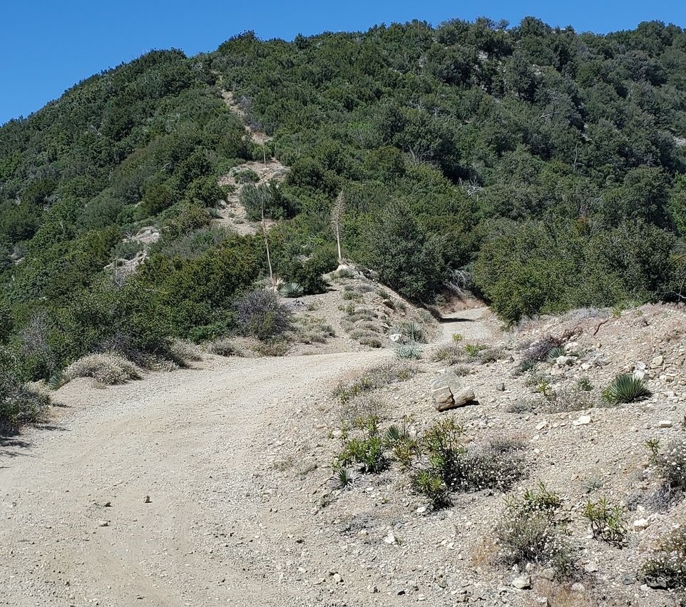
Keep right along the fire road at 3.2 miles, unless you feel very energetic and want to take the steep hiking trail.

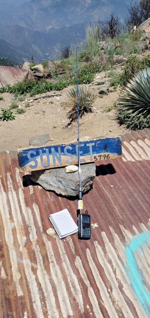
You will be at the peak soon
Notes & References:
W6PNG has good hike notes for this peak: https://nomadic.blog/2016/02/09/sunset-peak-w6ct-022/
The metal sheeting is the remnant of a fire lookout, decommissioned in 1974. The story is in https://californialookouts.weebly.com/sunset-peak.html/